
Mapping Flint: Flint Vacant Land
Alex B. Hill, dives into Flint’s vacant land.
Editor’s Note: This is part of the Mapping Flint series from cartographer Alex B. Hill, a self-described “data nerd and anthropologist” who combines mapping, data, and analytics with storytelling and human experience. He is the founder of DETROITography and author of Detroit in 50 Maps and Great Lakes in 50 Maps.
FLINT, Michigan — Flint is home to “The” Land Bank, or at least the first modern implementation of a public authority tasked with managing vacant properties. Today, there are 353 land banks at the city, county, or state level. Most land banks take advantage of state-level laws that enable them to exist, and in Michigan, that law was passed in 2004.
In Michigan, a new interpretation of brownfields, or any property that has been developed, opened the door for innovation in managing vacant and abandoned properties to bring them back to productive use for cities.
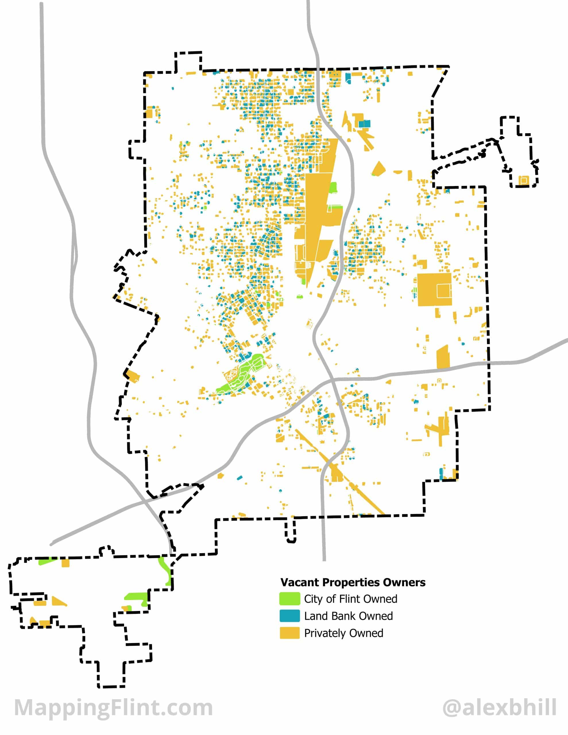
The Genesee County Land Bank Authority (GCLBA) has tracked its work since 2004 and boasts over 9,000 structures, has sold over 10,000 vacant lots, and has returned 5,000 lots back to community use. The GCLBA has taken control over over 14,000 properties in its time, but still has an inventory of 13,626 properties. The GCLBA’s property inventory is 80% vacant land. Across the City of Flint, there are over 17,000 vacant lots, and not all of them are publicly owned or managed by the GCLBA.
The distribution of ownership across vacant land in Flint shows how difficult it can be to manage land in a city experiencing economic stress. The majority of GCLBA’s vacant land is residential, while most privately held vacant land is commercial and industrial.
Author

Related Articles
Mapping Flint: Flint River Watersheds
Cartographer Alex B. Hill shares information about Flint’s watersheds and the impressive work underway.
Mapping Flint: Understanding Flint Geography
The “Mapping Flint” series from cartographer Alex B. Hill, a self-described “data nerd and anthropologist,” arrives at Flintside.


